Mt. Dinghushan
Mt. Dinghushan in the province of Guandong, China. The thin strip at
the bottom of the stamp is a map along the 15th parallel North of the
Equator. On the left is the Atlantic Ocean and Africa, on the right
Central America and the Atlantic Ocean.

Eugenius Romer's Atlas Geograficzny
A
relief map of Poland from Eugenius Romer's Atlas Geograficzny, 1908.

Aerial Photometry
The relief map of
French Polynesia is a high altitude photograph.

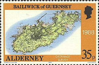
Ordnance Survey


|
