|
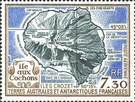
FSAT C109
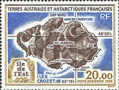
Many maps of the French Southern and Antarctic Territories are, like
these, monochrome shaded relief maps. This type of relief usually
exaggerates elevation with respect to horizontal measurements so the vertical shape of the terrain is
clearer. However, a shaded relief map does not provide specific
information about elevation as a topographical map does. (Note the
error in latitude on C109; it should be 45°05'.)
FSAT C136


|
