|
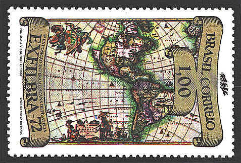
The map, Novissima et Accuratissima Totius Americae
Descriptio, was made by Nicolaus Visscher of Amstrdam around 1652.
The Visscher firm was operated by three men, father, son, and
grandson, all named Nicholas Jansz. The date of the map would
attribute the engraving of the map to the son (1618-1679).
The primary source behind the map is America
Septentrionalis by Henricus Hondius, the son of Jodocus, and
America Meridionalis by Jan Jansson.
Several features of the map show the
misconceptions of the period: Brazil bounded by two interlocking
rivers; California is shown as an island with the relatively flat
northern coastline; North America features a large open lake in the
Great Lakes region; Lake Ontario is noted as "Lac Contenant." The
northwest coast of North America wraps around toward the east. "Anian"
and "Straet Anian" are shown to the north and slightly east of
California.


 |
