|
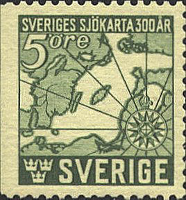
Under the direction of the
Swedish Admiralty Johan Månsson gathered
information on the Baltic Sea; sounding is coastal waters, the
location and shape of islands and shoals. In 1643 he was appointed the
senior navigation officer. The following year his Sjobook, or
Seabook was printed at Stockholm by Ignatius Meuer. Included in
the book was his Sjokarta or Sea Chart, based on the
information he had gathered. The stamp reproduces this map in
simplified form. The original chart has the long dimension east and
west, and the physical detail, soundings, names and so on is not
included on the stamp.

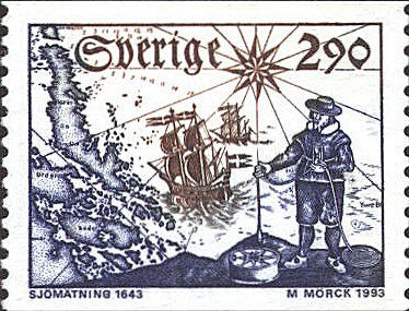
The stamp below shows Månsson holding a sounding lead and an hourglass. A
ship's compass is at his feet. These were the instruments used in the
17th century for hydrographic surveying. They depict part of the cover
of Månsson's Sjobook.
The chart pictured on the stamp is not from the
Sjobook. It was drawn by Johan Nordenancher in 1800, engraved by
F. R. Akrell, and published in Gustaf af Klindt's Atlas No. 6,
edition 16 (1805-1813). The stamp shows part of the chart of the
island of Oerskaer in the north, the Graesoe Island, the Oeregrund
Archipelago, the Aeland Sea and the waters to the north.

The information on these stamps comes
from
Water Klinefelter, A Small Display of Old Maps and Plans,
Iowa City, Prairie Press, 1962, pp. 41-44,
Stig Goeransson, The Cartophilatelist 38(1993)100,
and 39(1994)22.


 |
