|
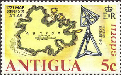
John Senex
The map of Antigua is from the Atlas of John Senex
published in 1721.
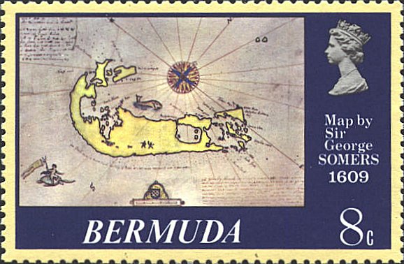
George Sommers
In 1609
Sir George Sommer wrote and published A Plaine Description of the
Barmudas, Now Called Sommer Ilands.With the manner of their discoverie
Anno 1609, by the shipwrack and admirable deliverance of Sir Thomas
Gates , and Sir George Sommers, which included this map. Gates and
Sommers are pictured as two small figures on the lower coast of the
island. Bermuda was known as Sommer Island after Sir George who died
there in 1611.
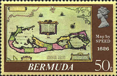
John Speed
This map
was compiled by Richard Norwood in 1622. It was the first English
printed map published in an atlas that showed Bermuda divided into
Tribes and Shares (Lots)--designating the properties given to the
"Adventurers" who were shipwrecked there in 1609. Note the minature
map below the titlepiece, inserted to show the relative position of
the island vis-a-vis the American mainland. This "little island that
isn't there" was thought by many later cartographers to be real, and
appears on at least 13 maps published during the next 150 years.
From A Prospect of the Most Famous Parts of the World....
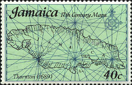
Thornton
John Thornton (1641-1708)
was and engraver and the leading English hydrographer of his day. He
was appointed hydrographer to the Hudson Bay Company and to the East
India Company. He worked closely for many years with John Seller, and
when John Seller was beset by difficulties in completing the later
volumes of the English Pilot, Thornton took over and
subsequently published Book III (1703) and Book IV (1689), the latter
in conjunction with William Fisher. He also assisted with the issue of
Seller's Atlas Maritimus (c. 1675) and later issued an atlas of
his own under the same title.

  |