|
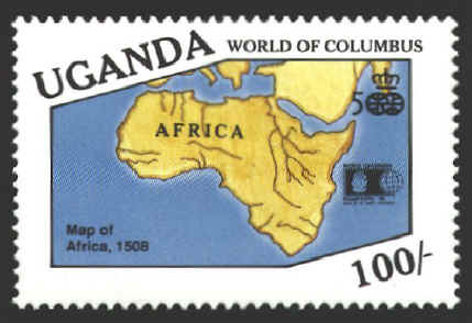
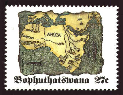
This woodcut map occupies the title-page of a rare
collection of voyages: Itinerarium portugallensium e Lusitania in
Indiam et Inde in Occidentem et demum ad Aquilonem, latine versum ab
Archangelo Madrignano. Mediolani. Kalendis
Iuniis MCCCCCVIII. This is a translation of a still rarer work:
Vesputio Florentino intitulato, printed at Vicencia in 1507. This
original does not contain the remarkable map which seems, at least for
some years, to have constituted the prototype of modern maps of
Africa. From the few inscriptions on the map, and from the name of the
only European town (Lisbona) marked on it, it is evident that it is a
composition of Portuguese origin.
A. E. Nordenskiold, Facsimile-Atlas to the
Early History of Cartography, p. 67.

This is one of the first printed maps. It was
printed in Milan, Italy in 1508. It is known in two states. In the
first state the Red Sea is called Sinus Persicus. In the second state
it has been corrected to Sinus Arabicus. The map on the stamp from
Bophuthatswana displays the first state.


 |
