March 7: Sighted New Albion, Drake's name for the west coast of North
America.
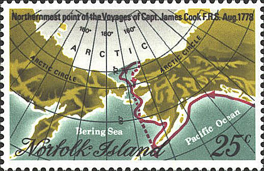
August 3: 62° 34´ N 192° 30´E
August 9: Named Cape Prince of Wales,
65° 46´N 191° 45´E, the extreme western extremity of the North American continent.
August 15: Named Icy Cap, 70°
N 198° 20´ E
August 17: Crossed the Arctic Circle
September 4: “...time to think of leaving these northern parts....”
October 26: Sailed for Hawaii
The longitudes above are Cook’s, which were measured East from Greenwich.