|
Salta, Argentina ~ 1785
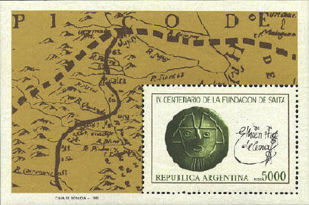
The stamp commemorates the
400th anniversary of the founding of the town of Salta, the capital of
Salta province in the Lerma valley in north west Argentina. It was
founded by Don Hernando de Lerma and was a military outpost in the
fight against the indians. It was also an important commercial and
cultural center during the 17th century. Salta appears in the upper
left area of the map.
The map on the stamp is a small part of map of postal
routes drawn by Manuel de Basavilbaso in 1785 with the title, in
English, A topographical map which shows the provinces subject to
the central administration of the royal revenue of the posts of Buenos
Aires and bordering holdings, and the royal post road to Mendoza,
Peru, and Paraguay, which belong to the said administration, a region
defined by the line of points colored in yellow.
The dashed line indicates a political boundary,
while the solid line shows the route of one of the two royal post
roads, this one from Buenos Aires to the northern border of the region
mapped. The signature on the stamps is that of Don Hernando de
Lerma, who founded the city in 1582.
Walter Klinefelter, "An Eighteenth
Century Postal Map,"
The Carto-Philatelist, Vol. 28, No. 4, pp. 8-9


 |
