|
The Norwegian Geographical
Survey (Norges Geografiske Oppmåling) was established in 1773. The
first county map was published in 1826. In 1845 the first of three
sheets covering the county of Christians (later Oppland) was
completed. It was based on observations by Artillery Lieutenant Soren
Chr. Gjessing. Sheets two and three were published in 1849 and 1851,
respectively.
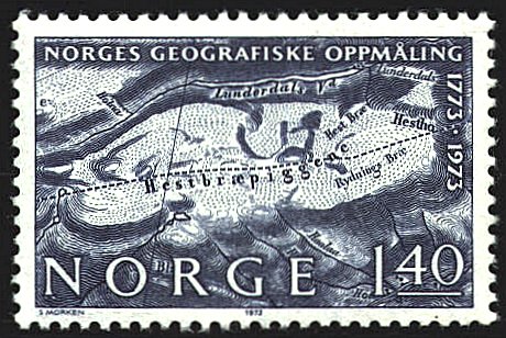
The design on the stamp is derived from the third
sheet, and represents a mountainous and glacier-covered area
designated Hestbræpiggene. Lieutenant Gjessing compiled the
data for the map, and prepared the manuscript maps. The manuscripts
were engraved for printing by the Chart Institute in Copenhagen.
 |