|
Paolo Toscanelli (1397-1482) was a physician,
cosmographer, astronomer, mathematician, geographer and author. In the
1474 he was asked to explain his theory that India, China and Japan
could be reached by sailing west to King Alfonso V of Portugal. This
he did in a letter and a map which he drew to illustrate his ideas.
Although the original and any copies of his map or maps are lost,
reconstructions of his work, based on his descriptions in the letter
to Alfonso, and the maps of Waldseemüller and Behaim, have given us
some idea of what his maps contained.
“Vertical lines running from the top to the bottom of the map give the
distances from east to west. The horizontal lines show the distances
from south to north....On my map there are twenty-six sections from
Lisbon sailing due west, of which each one is 250 miles wide...up to
the great city of Quinsai....From the island of Antilia, which you
call the ‘Island of the Seven Cities,’ to Cipangu [Japan] there are
ten divisions, in other words 2,500 miles or 625 leagues.”

The
stamp from Viet Nam shows the island of Cipangu off the coast of
Cathay, with the island of Antilia just below the lower leg of the
calipers. By his reckoning the distance from Portugal to Kinsai was
6,500 miles. Apart from the omission of the western hemisphere, this
distance was far short of the actual distances involved. Columbus, who
was influenced by Toscaneli, shortened the distance even further.
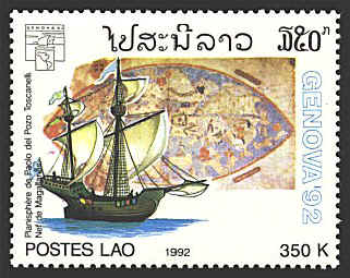
Seventeen years before his letter to King Alfonso Toscaneli painted
another map which is the subject of the Laotian stamp.


 |
