|
Gabriel
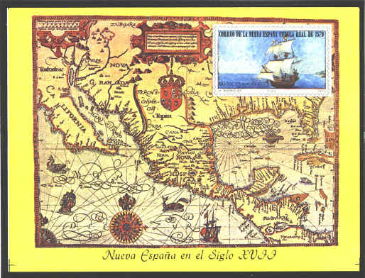
Tatton was a sixteenth century cartographer of London. In 1600 he
produced a map of New World which was engraved by Benjamin Wright. It
was reissued in 1616. The legend at the top says, “A new and recent
delineation of the lands and kingdoms of California, New Spain, Mexico
and Peru, together with an exact and absolute representation of the
Gulf of Mexico to the island of Cuba and as far as the shores of the
southern sea.”
Tatton’s map has been called the most beautiful map of
the New World of its date. It is an important map because it depicts
much of what had been discovered of the lower half of North America
since Columbus.
Lower California is shown as a peninsula, although some
believed it to be an island until Eusebio Kino proved that it was not
in 1705. In the upper left are the fabled Seven Cities of Cibola, and
the town of Tiguex where Coronado wintered in 1540. Florida extends as
far as the R. de Spiritus Santo (the Mississippi), discovered by
Hernando Desoto in 1541. In the upper right (under the stamp) are the
Mons Appalaci (the Appalachians).
In 1979 Mexico issued this airmail souvenir sheet with
Tatton’s map, marking the 400th anniversary of mail service in New
Spain.


 |
