|
Piri Re’is (1465-1554) was
an Ottoman navigator and cartographer. Re’is is a title meaning
commander. He served in the Turkish navy during the reigns of Yavuz
Selim (1512-1520) and Suleiman the Magnificent (1520-1566) He is known
as the author of an atlas of the Aegean and Mediterranean Seas called
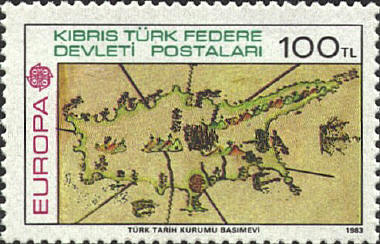
Bahriye presented to Suleiman. The stamp shows a map of Cyprus
from the Bahriye.

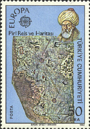
In 1513 he created the map
known as the “Piri Re’is map.” Only half of the map has survived. It
was discovered in 1929 and is preserved in the Imperial Library in the
Topkapi Palace in Istanbul.


“This map was drawn by Piri Ibn Haji Mehmed, known
as the nephew of Kemal Re’is, in the year 919 [March 9 to April 7,
1513].... In this century there is no map like this map in anyone’s
possession....From about twenty charts and Mappae Mundi...and from the
maps just drawn by four Portuguese...and also from a map drawn by
Colombo....By reducing all these maps to one scale this final form was
arrived at. So that the present map is as correct and reliable for the
Seven Seas as the map of these our countries is considered correct and
reliable by seamen.”
From notes made by Piri Re’is on his map
Gregory C. McInosh, "A
Tale of Two Admirals" Columbus and the Piri Reis Map of 1513,"
Mercator's World May June 2000, pp. 18-23.


 |
