|
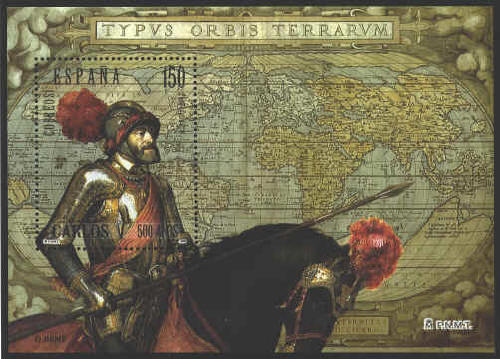
To celebrate
the 500 anniversary of the Emperor Charles V Spain issued a souvenir
sheet that displays the world map of Abraham Ortelius first
published in his atlas, Theatrum Orbis Terrarum in 1570. The
map is in the Library of Albert I in Brussels.
The oval projection of the map is similar to the one
used by Benedetto Bordone in 1528. The map was influenced by Gerard
Mercator whose map of twenty-one sheets was published in 1569.
The version displayed on the souvenir sheet shows the
word æternitas undivided as in 1570, but with the clouds of
1586, while the four islands to the east of Australia of 1587 do not
appear.
Titian’s 1548 portrait of the emperor on horseback
following his victory over the Protestants at the Battle of Mühlberg
(1547),is in the Prado in Madrid.

Ortelius' Typus Orbis
Terrarum (Image of the Countries of the World) was first
published in 1570. On the stamp the word
æternitas in the lower cartouche is
broken between the lines. This, and the shape of the clouds, indicates
that the map is based on Plate 2 from the 1586 edition of the
atlas, Theatrum Orbis Terrarum. The cartouche has a quotation
from Cicero: "Who can consider human affairs to be great, when he
comprehends the eternity and the vastness of the stars."
The stamp was issued in 2002 to commemorate the 500th
anniversary of the first circumnavigation of the world by Ferdinand
Magellan, 1519-1522. The medallion is identified as Carlos I, King of
Spain, who was also Charles V, the Holy Roman Emperor.


 |
