|
At the end of the 18th
century the Spanish, Russians and British were active in the northern
Pacific. One focus of activity was Nootka Sound. The name was given by
Captain James Cook in 1778. It was his attempt to pronounce the name
of the indigenous people, the Nuu-chah-nulth, meaning “all
along the mountains.”
It was rumored that the Russians were going to
establish a settlement on what is now called Vancouver Island. When
Spanish navigators arrived to assert the Spanish claim they found that
there was no settlement. A British vessel arrived and claimed the
right to build a forth there. The Spanish, under Estaban Jose
Martinez, engaged in piratical actions against the British in the
area. When the British threatened to retaliate, the Spanish agreed to
accept the terms of the Nootka Convention in 1790. Both nations were
permitted to use the harbor at Nootka, but neither was allowed to
establish a permanent settlement there.
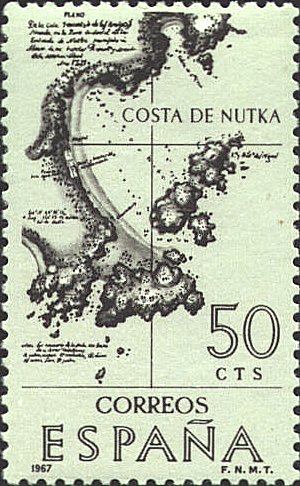
The chart
reproduced on the stamp is based on Plano de la Cala De Los Amigos,
Situado en la Parte Occidental de la entrada de Nutka, 1791 by J.
Espinosa y Tello, and published in 1802 in Atlas para el Viage de
las Goletas Sutil y Mexicana al reconocimiento del Estrecho de Juan de
Fuca in 1792. published in 1802.


 |
