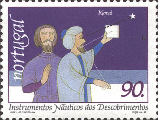
The Kamal is a device used by Arab
navigators to determine latitude. It is a wooden card approximately 2"
X 1", with a string with several knots attached through a hole in the
middle of the card. It can be used in different ways.
When a ship was leaving a port to which it intended to
return, the navigator would hold string in his teeth, and then hold
the card out until the top of the card touched a particular star while
the bottom rested on the horizon. He would then tie a knot in the
string where it was held in his teeth. To return to the port it was
only necessary to use the Kamal to find the latitude and then
"sail down" it to the port.
Another use was more generally to determine latitude. The
Kamal is prepared by typing knots at finger-width intervals
in the string. This interval was called issabah in Arabic, and
was about 1° 36' 25". By placing the bottom of the card on the horizon
and the top on a star one could approximate the latitude star by
counting the number of knots.

The picture on the stamp is incorrect in not
placing the bottom of the Kamal on the horizon, which is lower
on the stamp than the bottom of the card. In the case shown, the
Kamal would be much closer to the user, as in the picture below.


 |
