|
Pan-American Highway
An international highway connecting the countries of North and South
America was first proposed in 1923 at the Fifth International
Conference of American States. It was envisioned as a single route,
but has become a collection of highways in the participating
countries. During the 1940s and 1950s the United States financed the
highway. Today the system extending from Alaska to Chile includes
almost 30,000 miles of designated roads and only about 240 miles in
the so-called Daríen Gap on the border between Colombia and Panama.
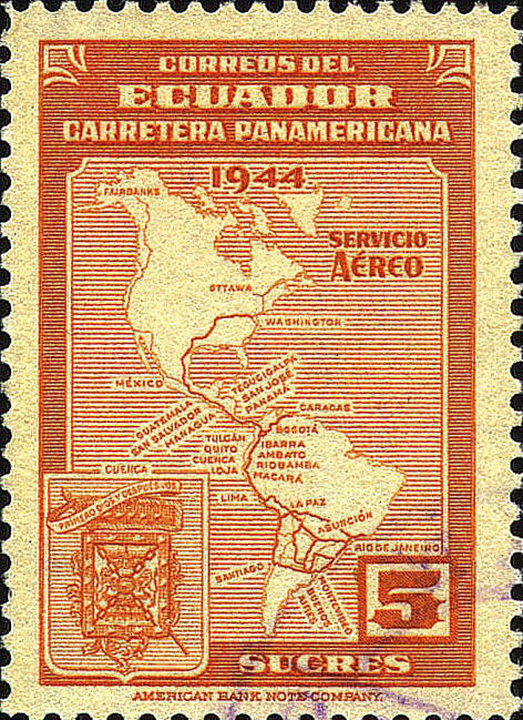
Five semi-postal stamps
with the same design, issued by Ecuador in 1946, display a map of
North and South America showing the highway from Washington, D.C.,
through Mexico and Central America, north in Colombia to Venezuela,
south along the Pacific coast to Santiago Chile, with a network of
roads in Peru, Chile, Brazil, Bolivia, Paraguay, Uruguay and
Argentina, and with additional routes from Fairbanks, Alaska along the
Pacific coast, through Mexico, and in the South American network. A number of cities, mainly capitals are indicated.
In the
lower left corner there is the coat-of-arms of Cuenca. The legend on
the flag, Primero Dios y Después Vos, "God First and Then You."
refers to the Virgin Mary.
Five postage stamps with a similar design, with arms of
Loja, were also issued.

 |