|
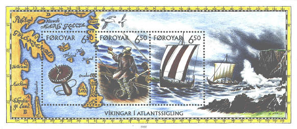
Faroe 413 was issued in 2002 to commemorate
Viking voyages on the North Atlantic. There are two cartophilatelic
items on the souvenir sheet, the map and the sun compass.
The map is a portion of the Skalholt map by
Sigardur Stefansson of Iceland in 1579,
based on a copy by Bishop Thordur Thorlaksson
around 1669.
Another reconstruction of a "sun compass" is in the stamp on the left. The
instrument is based on a partial disk found in Greenland in 1948 by C.
L. Vebæk of Denmark. The device is held with the disk parallel to the
ground. It is rotated until the tip of the sun's shadow falls on a curve
marked on
the disk; the pointer then points North.
Faroe Islands 221
This stamp was issued in 1991 to illustrate
celestial navigation. The star map shows how to locate Polaris, the
North Star, using the "pointer stars" of the Big Bear or Big Dipper.
Today the earth's axis points within 1° of Polaris. It will be closest
to the celestial pole in 2105-2127.
Because the North Star is not affected by the variation
in the magnetic field, it can be used to correct the
magnetic
declination.
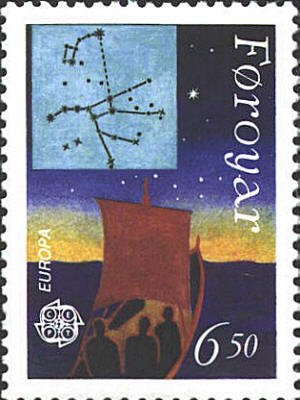
In the 16th century the
nocturnal was
invented to tell the local time at night, using the relationships
between Polaris and the pointers or the guards of the Little Bear.


|