|
Like the carved wooden map from Greenland
stick charts reflect a different perception of the world. They are
made with sticks with shells to represent islands. The straight sticks
are a framework. Curved sticks indicate ocean swells curving from
contact with islands.
There are two basic types of charts, the mattang,and
the rebbilib. The mattang is used only for instruction.
On the mattang shown on the stamp a central island refracts the
swell into two areas, north and south, as shown by the right-hand
curved piece, while the curved strip to the left represents a weaker
pattern.

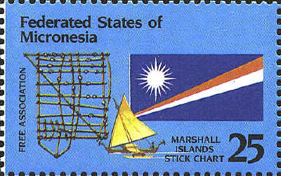
The rebbilib shows
the islands in the group or a chain of islands. There is some evidence
that this type of chart is an imitation of western charts. The
rebbilib on the stamps depicts the islands of the Marshall Group.
The islands of the group are shown by shells, and the three curved
sticks represent the swell. These charts are generalized in terms of
direction and distance, so they cannot be used like a western chart.
They are not taken on a voyage, but rather their general shape is
memorized and supplemented by the experience of the navigator.


The stick chart is based on the chart below documented by an
ethnographer named Winkler in 1901. The chart was reproduced in We
the Navigators by David Lewis, who named each island represented
by a cowrie shell on the chart.

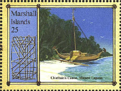
Each stamp on the Robert
Louis Stevenson commemorative sheetlet has the same stick chart. It is
one of the few that shows the entire Marshall Island chain, and was
given to Stevenson by the great King Kabua, ruler of the Marshalls.

The following is another rebbilib which covers a
large part of the archipeligo. It is more concerned with the islands
than with the swells.


 |
