|
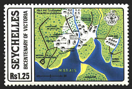
Plan of 1782
'L'Establissment'
Nine hundred miles east
of Africa, in the Indian Ocean, is the archipelago of Seychelles. It
is comprised of about 115 islands in 175 square miles. In 1990 its
population was estimated to be 68,336.
The Portuguese
charted the islands in 1505. In 1742 the French took possession, and
began settling in 1770. In 1814 the islands were passed to Great
Britain by the Treaty of Paris, and governed as a dependency of
Mauritius, 1,100 miles to the southwest. In 1903 Seychelles became a
separate crown colony, and the Republic of Seychelles gained its
independence from Great Britain in 1976.
The capital of
Seychelles is Victoria on the island of Mahé. The stamp displays a
plan of Victoria as it was in 1781, when the French were still in
possession.
The map is an adaptation of Plan Particular de
l'Establissement du Roy a Mahe, Ile Seychelle, commence par M. de
Rommainville en 1778. Releve par M. Bertholet. Fecit en 1782.
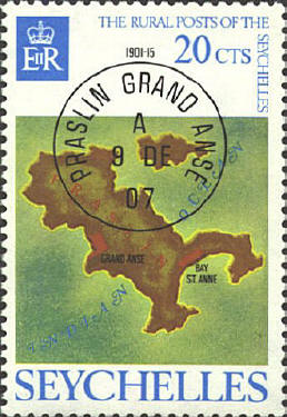
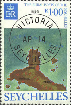
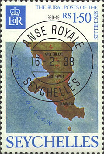
In 1976 The Seychelles
issued a set of four stamps recognizing their rural posts. The design
shows a map of the island and a postmark: Praslin, Grand Anse; Digue,
Digue, and Mahé, Victoria and Anse Royale. Above the postmark are the
years the post office was in service.

 |