|
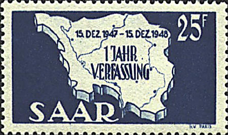
The Saar lies on the
border between France and Germany southeast of Luxembourg. Before
World War I the Saar was a German territory, but from 1920 to 1935 it
was administered by the League of Nations. Then it was returned to
Germany. After World War II France controlled the Saar until 1957 when
it was again returned to Germany.
The stamps show an outline map of the Saar with rivers,
and some town indicated. The stamp was issued in 1948 to commemorate
the 1st anniversary of the establishment of the French Protectorate
after WW II.
The Saar River runs North to South along the western
border. The dot under the A in Verfassung is Saarbrücken.
Homburg is to the east of Saarbrücken, and Merzig and St. Wendel are
across from each other in the northern area.

|