|

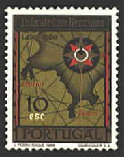
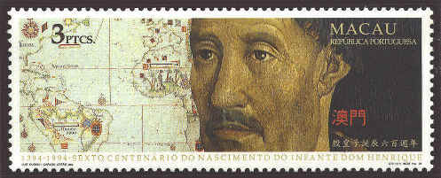
Prince Henry, the Infante
of Portugal, governor of the Algarve, established the first school of
navigation at Sagres Point, Portugal. The map of Sagres Point is
derived from an unsigned and undated map, Chart of the Promontory
of Sagres, in the Portuguese Geographical Institute in Lisbon.
Four countries, Portugal
(1987), Macau (719), Brazi (2463)l and Cape Verde (664), issued stamps
with the same design. The map on the left side of the stamps extends
to about 25°S and probably further. Explorers reached that latitude by
1585. So, the map is later than that. Similar maps are a chart by
Domingos Sanches dated 1618, an anonymous Portuguese planisphere from
the late sixteenth century which the French attribute to Pedro de
Lemos, while the Portuguese assign it to Sebastião Lopes around 1585.
In any case the maps are about a century later than Prince Henry.
For more information on Prince Henry see, "Crusading by Sea,"
Mercator's World July/August 1999, pp. 54-61, and "The Legacy
of Prince Henry 'The Navigator' Re-Examined," Mercator's-World
May/June 2001, pp. 44-49.


 |