|
In the thirteenth century a
new type of chart, the portolan chart emerged. A cartographic
revolution. They were created by mariners who plotted coastlines along
constant compass bearings. Wind roses indicated directional bearings.
Portolan charts were made to get seafarers from home to another place
and back again safely. There is a great deal of detail on the coasts,
but very little in the interior.
The green protrusion on the
coast of Africa represents Cape Verde. The map is called “A Portuguese
Nautical Map” about 1471. The mapmaker is unidentified

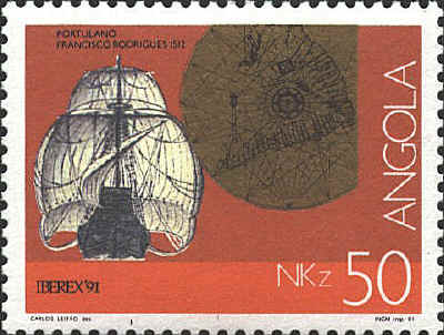
The next stamp shows a
portion of a map in The Book of Francisco Rodrigues / Rutter of a
Voyage in the Red Sea, Nautical Rules, Almanack and Maps, Written
and Drawn in the East before 1515. The portolan was compiled about
1513
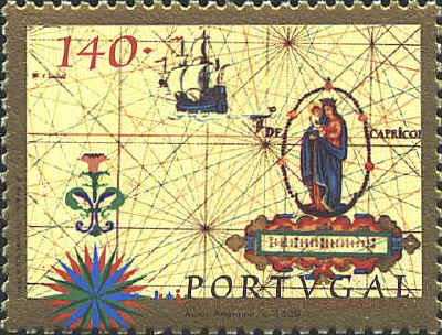
Though not strictly a
portolan the stamp shows a portion of an anonymous Portuguese map from
about 1630. The red line is the Tropic of Capricorn.


 |
