|
To
identify location of a town or hill or ship on a map it is necessary
to know the coordinates of latitude and longitude. Latitude is
determined by measuring the angle between the horizon and the
North star. The earliest instruments for measuring this angle were the
"latitude hook" of the Polynesians and the Arab "kamal."
The kamal is pictured on Portugal 1943. To my
knowledge the latitude hook is not pictured on a stamp.
The instruments for measuring latitude that are
pictured on stamps are the cross-staff, the quadrant, and the
astrolabe, the back staff, the sextant and the octant. The
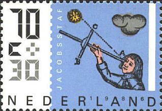
cross-staff, also known as the balestila, jackstaff or Jacob's staff
was introduced in 1342 by Levi ben Gerson. It has a long graduated
staff with a movable cross-member. The eye is placed at one end of the
staff, and the cross-member is moved until the lower end touches the
horizon and the upper end touches the star or sun.

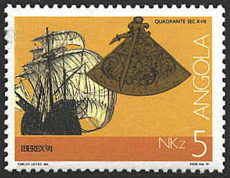
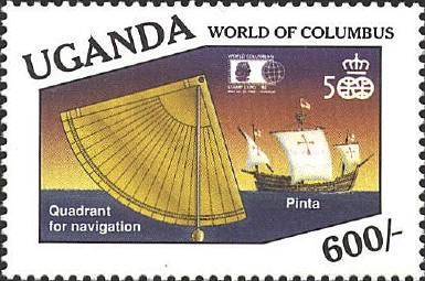
The quadrant comes from about the same time. The
quadrant is a quarter circle with a scale engraved on the outer edge.
The star or sun is lined up on one leg of the quadrant and a weighted
pointer marks the angle on the curved scale.

  |
