|
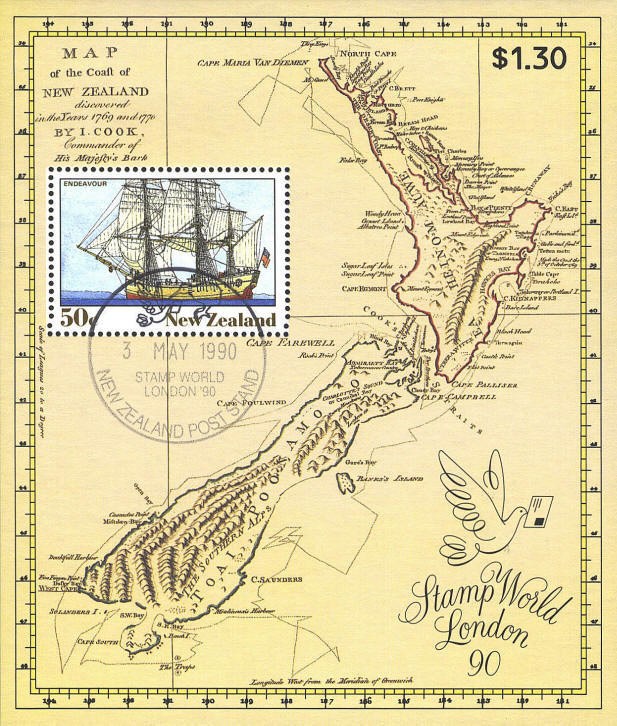
This miniature sheet was issued by New Zealand in 1990 to commemorate
the Stamp World Exhibition held in May that year in London. The map on
the sheet is a reproduction of Captain James Cook's chart of
1769-1770. There are two specific errors on Cook's map: Bank's
Peninsula on the East coast of the South Island is drawn as an island
and identified as "Banks's Island," and Stewart Island at the very
South end of the South Island is shown as connected to the mainland.

 
 |
